Yango launches Yango Maps, an app with a highly detailed map of Dubai and a seamless new navigation experience

Dubai, 2 November 2023
Yango, a tech company that aims to improve the daily lives of people around the world through innovative solutions, has launched Yango Maps in Dubai. With this navigation app, users can plan fast and convenient routes for driving, walking, or public transport while enjoying a highly detailed map with impressive 3D models of landmarks. The app also provides a smart view of driving routes and suggests convenient parking spots. Yango Maps is available for free on Google Play and the App Store, with both English and Arabic for the interface and voice directions.
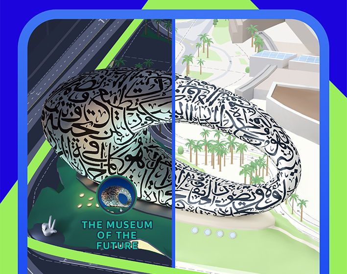
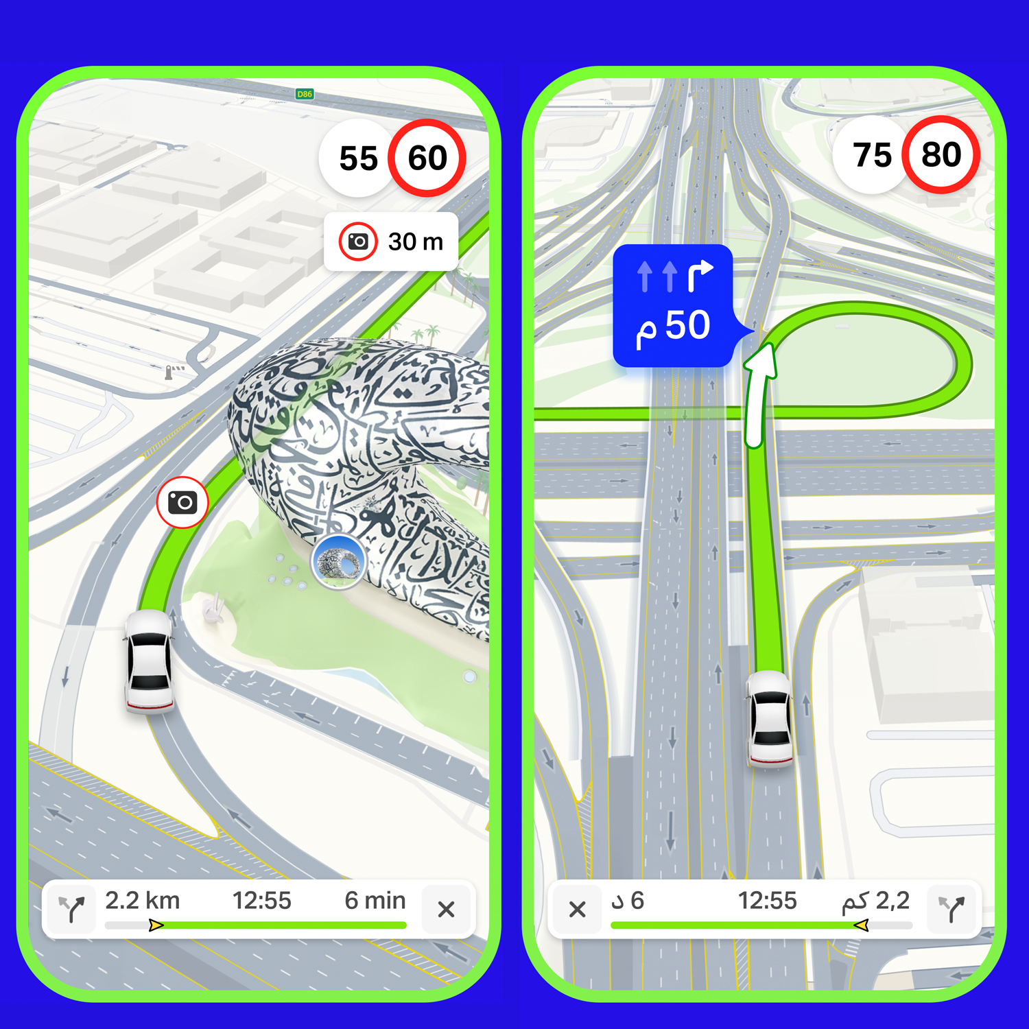
Yango Maps presents a true-to-life depiction of Dubai, with roads, buildings, underground crossings, and even some natural elements like trees visible on the map. In fact, the roads are displayed exactly how you see them in reality: over 3,000 km of roads in Dubai have been mapped out in high detail, reflecting lane markings, multi-level interchanges, tunnels, traffic lights, parking spots, and more. The app also introduces an adaptive view of the route, which highlights important details of the road up ahead and zooms in on complicated turns for safer, well-informed driving.
Yango Maps also provides real-time traffic updates in addition to speed limit alerts that are voiced in advance. When the destination is a department store, a business center, or a place in a popular district, Yango Maps displays nearby parking options before the user starts driving so they can plan a route straight to a parking spot.
Yango Maps also has useful features for those not in the driver’s seat. Users can book rides via the built-in Yango ride-hailing service, check relevant bus schedules, and travel along streamlined walking routes. That makes it convenient to navigate the city on any mode of transport. As well, finding new, interesting places to explore is as easy as typing the location name in the search box.
In another step toward an enhanced navigation experience, Yango Maps displays iconic Dubai landmarks in full-color 3D, including Burj Khalifa, Dubai Frame, the Museum of The Future, and the Jumeirah Mosque. Switching to dark mode triggers lifelike lighting effects on the 3D models, realistically replicating the city’s evening ambience.
“We’re excited to launch Yango Maps in Dubai and invite everyone to enjoy a new seamless navigation experience in the city. We make sure to keep Yango Maps up to date to provide an accurate, hassle-free navigation experience.
To put it into perspective, we add roughly three million updates to the map every month,” says Alexander Baksheev, CEO of Yango Maps. “New businesses, roads, speed cameras, and interchanges go live in Yango Maps shortly after they appear in the real world, which is especially important for constantly changing, innovative cities like Dubai.”
“Since the launch of Yango’s services in Dubai over a year ago, we’ve been aiming to provide high-quality services to meet the day-to-day needs of the city’s residents,” adds Islam Abdul Karim, General Manager of Yango GCC. “Today this includes the Yango ride-hailing service, Yango Delivery, a last-mile delivery solution provider, Yango Tech, which offers e-commerce solutions, and the recently launched Yasmina AI-based Arabic-speaking smart assistant.
Yango Maps now joins this ecosystem to provide seamless navigation for Dubai, along with a detailed map of the city, real-time updates about road events, and many more convenient features to come.”
Yango is a tech company that transforms global cutting-edge technologies into seamlessly integrated services for different regions. Our mission is to bridge the gap between leading world innovations and local communities, fostering connections and enhancing everyday living experiences. The Yango ride-hailing service, Yango Delivery, Yango Tech (e-commerce software), Yasmina (AI-based voice assistant), and Yango Maps are available in the UAE.
Yango Maps extends Dubai’s signature comfort and ease of living to navigation. Users can plan fast, convenient routes to wherever they need to go no matter how they want to get there: by car, on public transport, or on foot. The app has a variety of useful features, including highly detailed road markings, speed limit alerts, up-to-date public transport schedules, an integrated ride-hailing service, and offline maps.


